Sunday, November 1, 2009

The Amazing History of the lands covered by today's Karakalpakstan


Map of the greatest extent of the Mongol Empire (Shaded area that of the Timurid empire) early 14th Century

This is a brief history of the rulers of the region today known as the Republic of Karakalpakstan. Encompassing the lands south of the Aral Sea, the lower delta of the Amu Darya River, the Ursturt Plateau to the west and the Kyzylkum Desert to the east.

The first inhabitants of the region were the cattle-breeding Apasiak marsh dwellers, part of the Saka-Massagetae, which populated the delta and the adjoining desert lands of Aral-Caspian in the early 1st millenium.

Irrigated agriculture started to develop in the lower flow of the Amu-Darya river by sometime in the mid 2nd millenium and by the 10-8th cc. BCE the beginnings of the Chorasmian civilization started to emerge.

During the 7-5th cc. BCE as more advanced irrigated agriculture developed with the construction of the large diversion canals, fortified settlements and multiple villages this becomes more formalised and a specific Khorezm state developed known as CHORASMIA. Some 300 fortresses and temples are still from this epoch are still to be found in Karakalpakstan and adjoining Khorezm.

CHORASMIA which was established perhaps as early as c. 1300 BCE, next to nothing is remembered about it's early history.

Sijav..............................................fl. 1300's BCE ?
Vishtaspa.......................................fl. c. 1000 BCE ? is recorded in Zoroastrian scripture as the first patron of the prophet Zarathustra (Zoroaster).
Aurvat-Aspa....................................... fl. late 600's
Arsames (Arshama)................................early-mid 500's

To PERSIA..........................................530-350 BCE

Hypastes (Vishtaspa)..................................mid 500's-495 with...
Darius (Darayavahush; Persia 522-486).............530's-522 BCE

To the PHARASMANID.........................c.330 BCE-300BCE

Chorasmia however maintained its independence from the Hellenistic kings of both Bactria and the Seleucid Empire, and was probably only loosely associated with the Parthian Empire.

Pharasmanes (Pharashmanaya)..................fl. 330's-320's

The silk road trade route starts up in this era. The Pathians and Kushans both derived much of their revenue from the caravans crossing their territory carrying silk, gold, silver, and nickel from China to the Persians.

Vassal of PARTHIA................................c.200 BCE-27 CE

Chorasmia maintained its independence from the Hellenistic kings of Bactria and the Seleucid Empire, and was only loosely associated with the Parthian Empire.

Vassal to the KUSHANS...............................27-305 CE

The Kushans replaced the Greeks in Bactria in about 130 BC. They were mainly Yüeh-Chih a Buddhists people probably of Iranian stock with a strong admixture of Hephthalites (white huns), Saka, and Tocharian.

To the AFRIGID ...............................305-410 CE

In Khoresm in the early part of the 4th Century the Afrigid kings rose to power; their dynastic symbol – a horseman.

Afrig..............................................305-320
Bagra..............................................320-340
Sakhkhasak............................................??
Askadjamuk I ..........................................??

To the WHITE HUNS .................................. 410-565 CE

In AD 400 a new wave of nomads under the Hephthalites (believed to be eastern Iranian stock) emerged as rulers of much of Central Asia.

Hephthalites.......................................410-415
Askadjavar I.......................................415-445
Sakhr I ............................................... ??
Shaush .................................................??

To WESTERN TURKIC KHAGANATE, mid 6th- early 8th cent.

In alliance with the Sasanians, the Turks attacked and destroyed the Hephthalite empire (in AD 560), thereby gaining control over an important portion of the Silk Road leading from China to Byzantium and ruled the area right up until the Muslim conquest.

Gök...................................................565-652
Khamgari ..................................................??
Buzgar ....................................................??
Arsamukh...........................................fl. c. 600
Sakhr II ..................................................??
Sabri .....................................................??
Askadjavar II..............................710-712 opposed by...
Hurrazad...........................................fl. 710-712
Askadjamuk II...........................................712- ?

To the CALIPHATE.......................................c. 710-867

Under Abd al-Malik the Umayyad caliphate (661-750) conquered Khwarezm, Samarkand, Bukara, Fergana, and Tashkent and began an extensive program of Arabisation and conversion of the population to Islam. It was followed by the Abbasid caliphate (750-861) after which it collapsed as anarchy and rebellion shook the empire and local muslim rulers emerged.

To LOCAL PERSIAN RULERS.................................................867-900

In 875, the Samanid emir, Nasr I, receive a license from the Caliphate to govern all of Transoxania.

To SAMANIDS ...........................................900-c-1010

An Iranian dynasty who emerged after the Muslim Arab conquest and ruled from Bukhara until overthrown by the Mongol (Khitans).

In 892 Ismail ibn Ahmad ascended the throne and embarked on an ambitious struggle to convert Maverannahr (Transoxania) into a major power in the Muslim world. Under his rule, his state embraced the territory of all of present-day Uzbekistan, the northeast provinces of Iran, part of Afghanistan and South Kazakhstan.

Ismail I.............................................900-907
Ahmed II.............................................907-914
Nasr II..............................................914-943
Nuh I................................................943-954
Abd al-Malik I.......................................954-961
Nasr III...................................for 1 day, in 961
Mansur I...........................................961-976/7
Nuh II.............................................976/7-997
Mansur II............................................997-999
Abd al-Malik II..........................................999
Ismail II............................................999-1005

In 1005 the last Samanid ruler, Abu Ibrahim Ismail the Muntasir (Arabic for "victorious"), was killed and his state was divided between two khanates under the Turkic dynasties of the Karakhanids and Ghaznevids.

To the GHAZNAVID EMPIRE....................c. 1010-1074

Samanid Turkic rulers who spoke Persian (whose leaders originated from Heart in modern day Afghanistan) and ruled from Samakand.

Mahmud............................................. 998-1030
Mas'ud I ..............................................1031-41

To the SELJUG EMPIRE..........................1074-1141

Seljug Turkish empire built a vast empire which extended from Byzantium in the west to Tokharistan in the east, led by the ruling military families of the Oguz (Ghuzz) Turkmen tribes who ruled from Merv.

Nasr I Abu'l Hasan Shams al-Mulk..................1068-1080
al-Khidr Abu Shuja................................1080-1081
Ahmad I...........................................1081-1089
Ya'qub............................................1089-1095
Mas'ud I..........................................1095-1097
Sulaiman Qadir Tamghach................................1097
Mahmud I..........................................1097-1099
Harun Tigin.........................................c. 1099
Jibra'il Qadir Khan...............................1099-1102
Muhammad II Arslan Khan...................1102-1130 opposed by...
Nasr II......................................1128-1129 and...
Ahmad II..........................................1128-1130
al-Hasan..........................................1130-1132
Ibrahim II.............................................1132
Mahmud II.................................1132-1141 d. 1163

To the QARA KHITAL............................1141-1212

In the late 1130s a new formidable power, Qara (Black) Khitai, emerged on the eastern border of the khanate; a nomadic Manchu people originating from the Tarim basin (East Turkistan. In 1141 the Kara-Kitai destroyed the allied armies of the Seljukids and Karakhanids in a battle on the Katvan steppe. They established a ramshackle empire which merged with the Golden Horde in the 13th century. They lent their name to Chitay (Cathay) from which China is named.

Ibrahim III.......................................1141-1156
'Ali II Chaghri Khan..............................1156-1160
Mas'ud II......................................1160-1178 with...
Nasr III........................................1163-1173 and...
Muhammad III.......................................1171-1174
Ibrahim IV.........................................1178-1203
'Uthman Bughra.....................................1203-1212

Briefly to the neighbouring ANUSHTIGINIDS in Khiva ....................1212-1221

Muhammad Al ad-Din military success led once again to the rise of a powerful state of Khoresm shahs with his capital at Gurganj (Kunya-Urgench) today in northern Turkmenistan. His brief rule however came to an end in 1220/21, when Mongol armies under Genghis Khan swept through the region.

Muhammad Al ad-Din... ............................1200-1221

To the MONGOLS (GOLDEN & CHATATAI HORDES) ............1227-1395

Central Asia was invaded by the Mongol horde in 1220/21 led by Gengiz Khan. His forces destroyed all of Khorezms cities and towns and absorbed its lands.

Before his death in 1227 he assigned Turkistan to his second son, Chagatai, in the following century the horde gradually Turkified and Islamized especially under their greatest Khan, Öz Beg (1313-40).

Temujin Genghis (Chengiz) Khan.....................................1206-1227
Batu...............................................................1227-1255
Mangu..............................................................1266-1280
Ozbeg..............................................................1313-1340

KIPCHAK KHANATE.....................................1350s-1395

Encompassing most of the western part of the Mongol Empire the Golden Horde flourished from the mid 13th century. The people of the Golden Horde were a mixture of Turks and Mongols, with the latter generally constituting the aristocracy.

Timur's defeat of the Golden Horde in 1395 left a mêlée of different tribes and confederations between the Black Sea and the middle Syr Darya, including the Nogay Horde to the west and the Shaybani (Uzbek) Horde centred in south-western Siberia. Many of the surviving inhabitants of what is now Karakalpakstan being forced to seek refuge in the lower Syr Darya.

TIMURUD EMPIRE.................................1395 to around 1428

Timur Shah (Tamerlane the Great).....................1370-1405

Tamerlane was Emir in Transoxiana for the last Chagatai Khans. Whilst technically he was never the head of state - he was the leader and pursued his own agenda entirely and his putative overlords were purely puppets. On his death his decendents ruled in his name.

Whilst the Mongol invasion was traumatic, it was Timur’s invasion of Khoresm in 1395 that had the most profound effect on the oasis, it not only greatly reduced the population but the invaders totally destroyed (to their foundations) almost all the settlements and demolished the regions ancient irrigation system plunging the northern Amu Darya delta into a 200-year-long ecological crisis.

After Timurs death in 1405 the Timurud empire waned due to family splits and the north western areas of the empire came under the control of the Uzbeks in 1428.

BORJEGIN-Shaybanid ....................................1428 -1468.

During the 15th century many nomads from Siberia began migrating eastwards into the Syr Darya valley. At this time the Karakalpaks fell within the early Shaybanid hegemony under the early Uzbek Khan, Abu'l Khayr.

Abu'l Khayr (at Tyumen).....................1428-1468
Haidar...........................................1468

Devastating attacks by Jungars, Uighur tribes from the east, led to a tribal division along the Syr Darya in the 1460's and the emergence of separate Kazakh and Uzbek confederations. Not long after the breakup the Karakalpaks also started to form a seperate identity.

KARAKALPAK KHANATE ..............................late 1400s to 1759

It is not known exactly when but the Karakalpak Confederation emerged. It seems it started within the eastern part of the Nogay Horde during the 15th century, Karakalpaks moving eastwards in the mid-16th century following the Nogay civil war, first to the Syr Darya and later into the Amu Darya delta. The term Karakalpak it is believed derives from the term Chernye Klobuki (Black Hats) who served as frontier uards under the Kievan Rus.

By the early 17th century the Karakalpaks were stretched across a vast tract ranging from the lower reaches of the river Emba in the northern Caspian, to the Turgai river to the north of the Aral Sea, to the lower and middle Syr Darya in the east and to the Amu Darya delta in the south.

Sirdaq I...............................................fl. c. 1630's
Sirdaq II ...................................................??
Khusrau .....................................................??
Ka'ip Khan I..................................1717-1740
Batir Jani Beg................................1740-1745
Ka'ip Khan II (1745) in Khiva ..................1747-1757

The Amu Darya changed its direction again in the last quarter of the 16th century, flowing northwards back into the Aral Sea and creating an island of virgin marshlands known as Aral. Nomadic Qongrat and Mang'ıt tribes (now considered Aral Uzbeks) entered this empty region in 1620.

The majority of Karakalpaks at that time still remained settled along the upper Jana Darya and the Syr Darya, up until the 1720's when they and their Kazakh neighbours came under further attack from the Jungars. Some Karakalpaks fled east into the Ferghana Valley but the majority moved downstream into the lower Jana Darya.

In 1762 some 20,000 Kazakhs embarked on a massive raid on the remaining northern Karakalpak territories, forcing them even further south into the northern Amu Darya delta, especially along the banks of the Ko'k O'zek.

Here they found natural allies amongst the dissident Uzbeks who, having resisted rule by Khiva, had no desire to see an invasion by Kazakhs. Together the Karakalpaks and these Qongrat and Mang'ıt people were able to repulse further incursions by the Kazakhs and for a time keep Khiva at bay.

Ka'ip Khan I..................................1717-1740
Batir Jani Beg................................1740-1745
Ka'ip Khan II (1745)in Khiva ..................1747-1757

To KHIVA......................................1759-1873

Despite being nominally part of Khiva from 1759 it was not until 1869 that the Aral peoples were finally subjugated and settled by the ruthless Khan of Khiva, Muhammad Rakhim Khan.

The life of the Karakalpaks during the 19th century was a tough one - living in yurts in the mosquito and disease-ridden lands of the delta; subject to the whims of the Amu Darya; building irrigation ditches by hand to water their crops; unfairly taxed by Khiva; their lives and livestock vulnerable to raids by local Yomud tribesmen during the bitter winters. The majority lived in abject poverty, only their tribal and religious leaders being wealthy enough to maintain a semblance of their traditional culture.

This was a period of much instability and there were continuous rebellions against successor Khiva Khans up until Khiva itself was subjugated by Russia in 1873.

Sayyid Muhammad Rahim II.............................1864-1910

To RUSSIA..............................................1873- 1919

In the second half of the 19th century, the territory on the right bank of the Amu Darya was annexed from Khiva by Russia forming the Amu Darya Department of the Syr Darya Region of the Turkestan General Governance (1878).

At the conclusion of the Gendiamen’s agreement after which Khiva surrendered to Imperial Russia, the territory of the Karakalpaks, which lay on the right bank of the Amudarya river, was incorporated into Imperial Russia forming part of the Amu Darya section of the Turkistan General- Governorship, whilst that on the left bank it remained part of the protectorate of Khiva.

The plight of the Karakalpaks was not greatly alleviated by the Russian conquest in 1873, although the Russians did improve security and stimulated trade and the growth of agriculture.

Tsar Alexander II...................................1855(1873) - 1881
Tsar Alexander III .................................1881 - 1894
Tsar Nicolas II .......................................1894 - 1917

Part of Karakalpakstan (left bank) was under the KHIVA (PROTECTORATE)

Sayyid Isfandiyar....................................1910-1918
Sayyid Abd Allah.....................................1918-1920

With the collapse of Imperial Russia at the end of World War 1 real control in Khiva passed briefly to the warlord Djunaid Khan.

Turkistan was occupied by anti-Communist White Forces .....1917-1919

Djunaid Khan.........................................1918-1920

During the civil war most Karakalpaks as with other communities living in Karakalpakstan aligned with the Red Army to rid themselves of feudal Khiva and the murderous White Armies and in 1919 the region became incorporated into the Union of Soviet Socialist Republics.

To the SOVIET UNION.....................................1919-1991

After the revolution in 1920 the Amu Darya Department was restructured into the Amu Darya Region of the Turkestan Autonomous SSR. The Kara-Kalpak Autonomous oblast was established in 1924 and became part of the Kazakhstan ASSR. In 1930, the Kara-Kalpak Autonomous oblast joined the RSFSR Russian Soviet Federated Socialist Republics. In 1936 the Kara-Kalpak Autonomous oblast was restructured into the Kara-Kalpak Autonomous Republic and was incorporated into the Uzbekistan SSR.

Autonomous Republic within Kazakhstan ASSR...1924-1930

Established as the Kara-Kalpakstan Autonomous oblast within the Kazakh ASSR (Russian SFSR) on the 16th of February 1925.

Autonomous Republic within Russian SSR........1930-1936

Transferred to the Russian SFSR on the 20th of July 1930 and transformed into the Kara-Kalpakian ASSR on the 20th of March 1932 being transferred to the Uzbek SSR on the 5th of December 1936.

The Soviet era saw a radically improvement in the standard of living of the population and the rapid growth of agricultural and industrial production within the republic. The construction of the model city Nukus and universal education and health care. Within a generation the modern Karakalpakstan that is seen today had started to emerge.

Autonomous Republic within Uzbekistan SSR.....1936-

However as a result of this growth, substantial environmental damage emerged during the later part of the Soviet Era.

REPUBLIC OF UZBEKISTAN.............................1991

Since independence (within Uzbekistan) progress towards a modern developed state continues apace. Whilst its agricultural sector is still struggling with water shortages and problems associated with salination & desertification, Karakalpakstan has in the last decade emerged as one of the most important hydrocarbon producing regions in Uzbekistan and has a growing tourism and service sector.

Sources:

Khiva Guidebook 2001 Matyakub Madaminov et al and

http://web.raex.com/~obsidian/centasia.html

Friday, October 30, 2009

Neighbouring Regions of Karakalpakstan - Navoi


Navoi city is located 347 m. above sea level, on the left bank of the Zaravshan River 360 km. southwest of Tashkent (400 km.). Navoi city is the center of Navoi region.Most of the province is covered by the vast Kyzyl-kum desert. The population in 2004 was 825,000 people living in eight administrative districts with the main centres of population being Navoi City, Uchkuduck and Zerafshan.

The Navoi region like Khoresm and Bukhara also adjoins the Republic of Karakalpakstan

"Navoi" is named after the great Uzbek poet, philosopher and statesman Alisher Navoi and has a total area of 110 800 sq km or some 24,8% of the total land area of Uzbekistan.

Navoi today is one of the most industrially developed regions of Uzbekistan the economy being based on large mining, metallurgical and chemical industries. Including the Navoi Mining and Metallurgy Complex, OJSC “Navoiazot” the “JV JSC “Electrochemical factory” and JSC “Qyzylkumcement” (both centres of chemical production), JSC “UPP” (Construction materials), and OJSC "Navoi" (electric power). Currently there are some 40 industrial joint enterprises operating in Navoi with companies from China, Russia and South Korea predominating.

The agriculture sector is also important and includes the growing of cotton, grains, vegetables, watermelons, viticulture, astrakhan sheep and silkworms. There are also a number of food processing and textile plants.

Transport infrastructure is well developed: there are 8 rail stations, 3 airports and 4100km of developed roads. Navoi Airport is also now a major cargo hub for the Republic of Uzbekistan.

Sites to Visit
Whilst it does not have so many historical monuments as its neighbours its two parks Yujniy (South park)  is the favourite places among tourists and citizens.  Stadium, swimming pool and cinemas are located in this area. 

Near the City of Navoi in the town of Karmana is the beautiful Mirsaid Bahrom and Hanak Kasim Shayh mausoleums complexes, dating back to X-XVI centuries also nearby these are the ruins of Rabati Malik caravan-saray (XI century) once on the silk road.Also on the way to the town of Nurat (75 km away from Navoi town) is an ancient blacksmith forge from 15 c., and a system of wells dating to Middle ages.

In Nurat itself are found the ruins of the prayer house of Shaihul Nuri and the Spanjvakta Mosque built in 1582 by Emir Abdullah. The town also hosts the famous holy site "The Chashma mineral Springs". The Kasim Sheik mausoleum (X—XI centuries) is also located near the city.

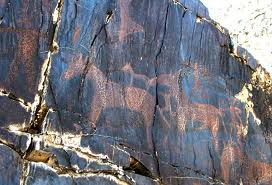
Nearby to Nurat are the beautiful and stark Nurat mountains in which many ancient rock inscriptions exist, dating to the bronze era which alone are worth coming to Navoi to visit. Numerous ancient rock paintings of people in strange clothes, some of which can be interpreted as images of "ancient astronauts" are found Sarmish gorge which is recognized as the largest canyon rock art gallery in the world. About four thousand of petroglyphs, which are engraved on the black shale are found in the area.

Friday, October 16, 2009

Neighbouring Region of Karakalpakstan - Bukhara

"The Kalayan Mosque at night"

THE BUKAHRA REGION

Situated in the south-west of Uzbekistan the Bukhara Region has a total area of 39 400 sq km supporting a population of 13 84700 people, 68% (rural). The Kizil-Kum desert occupies a large part of the region. The climate is continental and arid. There are 11 administrative districts the capital the City of Bukhara, with 263 400 people. Other centres are the towns of Gidlduvan, Romitan, and Kagan.

The region is the traditional centre of Uzbekistan's oil and gas industry and has rich Mineral resources including graphite, marble, granite, gypsum, sulphur and limestone. It is also a centre for cotton and the production of textiles and also has other light industry. The main agricultural products are cotton and cereals, karakul lambs and sericulture (silk). Bukhara is also known for producing astrakhan rugs with the only factory in Uzbekistan.

One of the most ancient cities of the East Bukhara sits at the crossroads of two ancient trade routes and was a large commercial centre on the Great Silk Road and like Khiva it is famous as an open air museum.


"Poi-Kalon (Minaret) - Bukhara"

Bukhara celebrated its 2,500-year anniversary in 1997; legend connects the appearance of the city with the name of one of the deities of the Zoroastrian pantheon; Siyavush. At different times the city had been known under different names: Numizkat, Madinat-as Sufia, Fakhirs, Vikhara (the latter in Sanskrit means “monastery”).

In the 9th century Bukhara became the capital of the powerful Samanid state.It was during its period as the capital of the Saminid state in the 9th and 10th centuries that Bukhoro – i- sharif (Nobel Bukhara), blossomed as a religious and cultural mecca. Among those nurtured here were the philosopher scientist Abu Ali Ibn Sino (Avicenna after whom the word medicine is derived) and the poets Firdausi and Rudaki still figures of great stature in the Persian and Islamic world. The famous doctor and philosopher Avicenna spent his childhood here, the poet Rudaki composed his verses here and medieval historian and poet Firdausi lived here, too.

Bukhara’s library was glorified for its wealth of manuscripts written in Greek, Arab, Persian, Chinese and other languages. In the Middle Ages Bukhara had become one of the core religious centres of Asia: numerous mosques and madrasahs were constructed. In 18th century Bukhara became the centre of the Bukhara Emirate which existed up until the beginning of the 20th century. Today Bukhara is an administrative centre of Bukhara Province. The city has a population of 250,000 peoples.

Bukhara has preserved its history well and is visited by tourists from all over the world. Afterwards came the smaller Karahhanid and Karakitay dynasties however and Bukhara was badly damaged in 1220 when it was attacked by Genghis Khan and by 1370 it fell under the shadow of Timur’s Samarkand.

It is also considered to be a place of glory in the Muslim world; since it nurtured the author of the second most important Islamic book after Koran, the book of authentic hadiths, "Al-jami as sahih" known as the Imam Al-Bukhari and is the burial place of Nakshbandi- the founder of Sufism and the author of religious warrant "Nakshbandi". Both make Bukhara an important place of pilgrimage.

Those who visit Bukhara, will likely see strange "shaggy hats" on the top of the minarets. These are storks` nests. The “white bird of hope” serves as the city's symbol, a symbol of its firmness and stability. More than once throughout its history this rich city suffered invasion. The most devastating that of Mongols, but each time Bukhara revived; and what is more, it always revived on the same place unlike the neighbouring capital of Khiva that kept on moving to new locations.

The most ancient part of Bukhara is its citadel , the Ark, where archaeologists excavated finds dating back to the 4th -3rd century B.C. It is a twenty meter high artificial mound, at the top of the entrance ramp is the 17th century Juma (Friday) Mosque. The Ark now houses a museum on the city’s history, and the Zindan (emir’s palace) is now a big tourist attraction, showcasing his harem, treasury and such skin-crawling rooms as the Bug Pit, a torture chamber and the dungeons built initially during the 11th - 12th centuries and rebuilt after the Mongol invasions.

Outside the fort is the Registan once famous as an execution ground. It has witnessed some brutal executions; in its time perhaps the most infamous being the killings of British officers Col. Charles Stoddart and Capt. Arthur Connolly in 1842. Victims of a misunderstanding between the Emir of Bukhara and the British government (which failed to supply its emissaries with the appropriate gifts and royal letters of introduction), the two were imprisoned in the Bug Pit at the Zindan , then forced to dig their own graves before their ceremonial beheading in front of the Ark (the Emir’s palace).

The highest point in the city is the grandiose Kalyan (“Great”) Minaret built in 1127,towering 47 meters over the city is the greatest remnant of truly old Bukhara; Genghis Khan who destroyed most of the city, left the minaret standing, supposedly because he was struck by its beauty. The minaret, which draws visitors up its 105 steps to see a panoramic view of the city, was once the tallest structure in Central Asia. It has been called the “Tower of Death,” because, legend has it, executions were often performed by throwing the condemned from its heights.

Slightly narrowing at the top, its round tower it is the tallest minaret in Central Asia From top to bottom it is trimmed with a relief design constructed of blue glazed tiles. The ornamented bands ringing the minaret emphasizing its size and upward direction. At the same time, the diversity and rhythm of ornamental motifs enriching what is a rather simple and clear architectural form.

At the foot of the minaret connected by vaulted galleries is the famous is the “Poi Kalyan” ensemble. Opposite the mosque, its luminous blue domes in sharp contrast to the surrounding brown is the still functioning Miri-Arab madrasah built at the beginning of the 16th century it is amongst the most striking in the whole of Central Asia.

One of the oldest monuments of Bukhara is Ismail Samani mausoleum built at the beginning of the 10th century by the founder of the Samanid dynasty. The mausoleum is a perfect brick cube covered with a hemispherical cupola. This mausoleum of the samanids emirs with its beautiful decorative elements was the first major buildings in Central Asia to be built of fired bricks.

Nearby is the Chasma (city springs) of Ayub mazar that date back to the 12th century. According to the legend, the biblical prophet Ayub was once passing this waterless part of Bukhara, stabbed the ground with his stick and instantly there appeared a source with clear healing water. These artificial pools “hauzes” were not only for practical use (water and to cool the populous) but also to decorate the city.

In Bukhara at one time there were more than eighty pools. The most famous one is Lyabi-Hauz, which is surrounded by a plaza with cafes where people gather to eat, smoke and talk throughout the day. On the east side of the Lyabi-Hauz plaza is a statue of the wise fool Khodja Nasreddin (created by the folklorists Dakiki who also hailed from Bukhara) who appears in sunni teaching tales throughout the islamic world. Further east is the Nadir Divanbegi Madressa (1622) and to the west of the square the Nadir Divanbegi Khanaka. North is the Madrassah of Kulbaba-Kukedash (1568/1569) once the largest centre for religious studies in Central Asia.

Bukhara is not only famous for its mosques and madrasahs, mausoleums but also for its caravan-sarays, baths and multi domed bazzars which have been preserved and are still used as the main market. The bazzar includes the Taki-Zargaron ("the Dome of Jewellers"), the Telpak-Furushon ("The dome of cap makers") and the Taki-Saraffon ("The Money exchange").

Other important historical and architectural monuments of Bukhara:

* Ensemble of Bola Hauz, (early 18th - 20th centuries)
* Mausoleum of Samani, (9th - 10th centuries)
* Mazar of Chashmoi-Ayub, (1380 or 1384/1385)
* Madrasah of Abdulla Khan, (1596/1598)
* Madrasah of Madari Khan, (1556/1557)
* Mosque of Baland, (early 16th century)
* Ensemble of Gaukushon, (16th century)
* Khonaka of Zaynutdin Khoji, (1555)
* Khanaka of Nodir Divanbegi, (1620)
* Madrasah of Ulugbek, (1417)
* Madrasah of Abdulaziz Khan, (1652)
* Mosque of Bola Hauz, (1712)
* Mausoleum of Sayfiddin Boharziy, (2nd half of 13th - 14th centuries)
* Mausoleum of Buyon Kuli Khan, (2nd half of 14th, 15th or 16th c.)
* Mosques of Namazgoh, (12th - 16th century)
* Khanaka of Fayzabad, (1598/1599)
* Madrasah of Chor-minor, (1807)
* Chor-Bakr - The burial place of Jubayri Sheik's family, (1560/1563)

Outside of the city is

* The Summer Palace of Bukhara Emir Sitorai Mokhi Hosa, (late 19th century).
* The Holy Complex of Bahautdin Nakshbandi - includes the burial tomb of Nakshbandi
(1318-98)- the founder of the most influential Sufisi order and the author of religious warrant "Nakshbandi". One of the most holy places in the Muslim world.

Other places of interest in Bukhara Province are the Vardanzi and Kyzylkum Nature Reserves both established in the 1970ies to protect the rare Bukharin deer. Also found in the parks are the amudarian fasan, steppe cat, jackal, antelopes, wolves, various species of snakes and rodents.

A description of the main attractions:

1. Citadel Ark (VII - XX Centuries) - most ancient of all the Bukhara’s architectural monuments. Built on the place of a more ancient original fortress, Ark has seen multiple reconstructions and served as a residence for Bukharian rulers. The Citadel covers an area of about 35,000 sq. m. Mint and jeweller workshop, Vasir`s (minister) offices, jail, warehouses, small emir’s mosque, harem - all situated in the Citadel. Today Ark has number of museums: History Museum, Philately Museum and an Ethnography Museum.

2. One of the most famous architectual masterpieces is the Samanid Mausoleum (9th to 10th Centuries) - Family burial-vault of the Bukharian Samanid governors, one of the earliest known monuments of burnt brick built at the territory of Uzbekistan and perfectly preserved to our days. Architecture of the monument amazes by its harmonious simplicity, proportionality and singularity. The monument does not have any external plastering or tiling, instead, the builders were using just bricks positioning in such a way that to create unbelievably unique patterns, which change their look as the day progresses depending on the light intensity from deep shadows to a light and transparent lace.

3. Poi-Kalyan Complex including a cathedral mosque Kalyan (15th century) and the almost 50-metre tower of Kalyan minaret rises in all its splendour over the city
minaret Kalyan (1127). The facade of the mosque is decorated by glazed bricks, and the domes and the arches - by the superbly restored mosaic tiling intricately composed in inimitable epigraphic, geometrical and vegetable designs. Minaret Kalyan is 45.6m high and even today is the highest building in Bukhara. External surface of the tower is adorned in ten decorative belts each having its own geometrical pattern of bricks. A magnificent "sky light" completes the vertical of the minaret.

4. Chor-Minor (1807) - the original structure presenting what is left of a once small madrasah with a gateway structure of four small (some believe, Indian-style) minarets.

5. Kukeldash Madrasah (XVI), Lyabi-Haus Complex (XVII) – an basin of bricks 36m x 46m x 5m set in the wrench of 500-year old mulberry trees, a largest in Bukhara Kukeldash Madrasah and two structures linked to a name of the Bukharian Minister someone Nadir Divan-Begi: the Hanako (hostel and mosque combination) and Madrasah (both XVII).

6. A cult architectural complex of Bahautdin Nakshbandi (XIV - XVII) - created on the burial place of Nakshbandi – the founder of the Sufi Nakshbandia Order and a most respected saint and patron of Bukharian townsfolk. The complex includes two large mosques, a Holy Grave of Nakshbandi, a sacred well, a minaret, a basin and a trunk of an old mulberry tree ostensibly planted by Nakshbandi himself.

7. Sitora-i Mohi Hosa (XIX-XX) – the summer country-side residence of Bukhara emirs. Architectural style of the Palace is eclectic to include elements of both Eastern and European architecture. Interior most richly adorned in fretwork, white alabaster- and wood carving and marble supplemented with true masterpieces of the Bukhara textile craftsmen. Huge courtyard where antelope-gazelle used to roam and where peacocks and pheasants still walk about harmoniously completes a unity of the architectural ensemble.

8. The Jeyran Antelope Sanctuary - is situated 40 kilometres away from Bukhara near the town of Karaulbazar in the steppe land area. On its huge territory variety of wild animals are being preserved such as jeyran (steppe antelope), cheetah and Prjevalski Horse. Tourists have a chance to photograph the nearly extinct species in their natural habitat.

Monday, October 12, 2009

Qarataw Vodka


People in Karakalpakstan are very proud of their Vodka which is reputedly one of the best in Uzbekistan.Vodka is sold in half litre bottles (sometimes 250gm) and also see below in 1.25 litre display bottles.

Qarataw Vodka

Toasting is an important part of Karakalpak Culture. Every guest takes his turn as toast master. The toast master stands up, his glass of vodka in hand and delivers a short speech, which ideally includes the following elements: thank you to the host, praise of the host or special celebrant/s (wedding/birthday), something witty or from the heart, and best wishes to the toastee their family and for all at the table for long life, good health and prosperity.

Then everybody clinks their glasses in the centre of the table or if a large gathering around the table. If you are drinking a decent sip will do, however in a direct toast you are expected not leave anything in your glass. When drinking at a celebration it is best to rapidly lay into a strong foundation of bread and cheese since the first toast usually will be given within minutes.

In many households in Karakalpakstan vodka is also an essential part for dinner, especially meat dishes. The other  most common brand is No'kis also made in the same distillery.

1.25 litres Qarataw Vodka
 

Sunday, October 11, 2009

Transport in Karakalpakstan

Air Transport

There are three airports in Karakalpakstan: Nukus, Muynak and Turtkul. In Muynak and Turtkul the runways are only able to take small aircraft.

Nukus City Airport has the capability of landing large passenger and freight aircraft. Flights to and from Tashkent (twice/three times a day) and to Moscow, St Petersburg and Samara in the Russian Federation (3-4 times a week).


Timetable for flights from Nukus to Tashkent

Uzbekistan Airlines has nonstop flights between Nukus and Tashkent.

Flight
Operational days
Departing
Arriving
Aircraft
HY1002
Tuesday, Wednesday, Thursday, Friday, Saturday, Sunday
10:35
12:50
IL-114
HY1006
Monday
15:55
18:10
IL-114
HY1004
Monday
20:20
21:55
A320
HY1008
Wednesday, Friday, Saturday, Sunday
20:55
22:30
A320
HY1010
Wednesday, Sunday
21:05
23:20
IL-114
HY1008
Thursday
21:45
23:20
A320
HY1008
Tuesday
21:55
00:10
IL-114


Timetable for flights from Tashkent to Nukus

Flight
Operational days
Departing
Arriving
Aircraft
HY1001
Tuesday, Wednesday, Thursday, Friday, Saturday, Sunday
07:10
09:55
IL-114
HY1003
Monday
07:50
09:35
A320
HY1005
Monday
12:30
15:15
IL-114
HY1009
Wednesday, Sunday
17:40
20:25
IL-114
HY1007
Tuesday
18:30
21:15
IL-114
HY1007
Wednesday, Friday, Saturday, Sunday
18:30
20:15
A320
HY1007
Thursday
19:20
21:05
A320

Road Transport

In Karakalpakstan there are 4,241 km of made roads and highways with almost all settlements within the republic being accessible by road.

Rail Transport

Railroads in the republic total 880 km total in length. The main railway from the east of Uzbekistan passing through Nukus onto Kungrad. The Chardjou-Kungrad-Beneu-Makat cargo railroad also passes through Karakalpakstan onto Russia and other European countries.


Communications

Karakalpak Telecom provide republic wide landline. Most post offices have nationwide and in Nukus in addition International Telephone Booths. Providers of cellular communication have good coverage in all built up areas.

Day Trips from Nukus - Mizdahkan


Photo: Mizdahkan Hilltop Credit: Geocoucou

The Archaeological and Architectural complex of ancient Mizdahkan covers a vast area of over 200 hectares.
 
A half day tour of Mizdahkan requires around 2-3 hours in total from Nukus to visit. It is located 19km accessible by bus / taxi from Nukus; to visit including visiting the beautiful Mazlumkhan Sulu, Shamun nabi and Halfa Yereshep mausoleums and the archaeological site Gyaur-Kala Caravanserai.
 
Mizdahkhan is located 3 km from the town of Xo‘jayli also spelled as Khodjeyli and Khodzheyli (Uzbek: Xo‘jayli / Хўжaйли; Karakalpak: Хojeli / Хожели; Russian: Ходжейли)  and is situated along one of the northern branches of the Silk Road - today the main arterial route from Kunya-Urgench across the border in Turkmenistan to Nukus and then onto the northern regions of the Republic - Kungrad and Muynak and up onto the Ustyurt plateau.

Mizdahkan sits on three hills on the south-western outskirts of Khodjeili, and consists of the antique pre - Mongol town of Gayur - kala, the religious centre the hill of Mazlumkhan sulu and the ruins of the unfortified city built during the period of the Golden Horde (the 13th-14th centuries AD.) that was once a major trade and handicraft centre of the ancient Khorezmian state. The first settlement on the site was formed sometime in the 4th century B.C. and building lasted until the 13th century A.D when the city was destroyed by the invading Mongol-Tatar tribes.

During 1985 - 1999 archaeologists excavated dwellings, streets and small hills containing rich ceramic complexes (pottery kilns and ceramics for food and wine), various domestic utensils, glass, unique ossuary’s, coins and highly artistic silver and golden articles. Many Zoroastrian sepulchres being preserved in the eastern part of Mizdahkan.

Today, one finds thousands of tombs, mausoleums, shrines and small qalas all over this hill. Some researches believe that the doctrine of Zoroastrianism was initiated and its religious teacher Zoroaster wrote his original holy book "The Avesta" at Mizdahhan.


Photo: Capitals - This finds show the high level of architectural décor in Khorezm in the 13th-14th c AD, which influenced not only on architecture in the steppe cities of Golden Horde, but also adjoining regions in Central Asia and the Northern Caucasus.

Gyaur Kala

Gyaur Kala (or Qala) meaning infidel fortress (name given by the Arab conquerors) is one of three Gyaur Kalas in the region. One is located not to far away across the river and south beside the Sultan Uvays hills and the other in Turkmenistan's Merv (old Avestan country of Mouru).The naming of these Kalas or fortresses as Gyaur Kalas assures us that they belonged to Zoroastrian kingdoms as the Arabs were particularly hostile and derogatory towards the religion.

The fortress appears to have been constructed and occupied by the 4th century BCE during the height of the Persian Achaemenid Empire. It also appears to have been destroyed by fire towards the end of the 2nd century BC and then rebuilt and occupied up to the 4th century AC until it was once again destroyed.

Photo:Mizdahkan looking west with the Necropolis in the foreground and
Gyaur Kala in the background. Credit: Zoroastrian Heritage


Necropolis

The two hills closest to Khodjeili are covered by a vast necropolis - a large, elaborate, ancient cemetery - literally a city of tombs and graves. Numerous ossuary's, coins, domestic utensils, items made from glass, and exquisitely crafted gold ornaments and objects have been excavated and removed from the site.

The oldest burials sites are found on the north-eastern hill and date back to the 2nd century BC. These sites show the use of Kurgan like burial practices, a practice prevalent amongst the nomadic people. Kurgans had mound covered graves that often contained artefacts. memorabilia and items to assist the dead in their afterlife. Usually, the size of the mound indicated the status of the person.

Over time the necropolis has been shared by many different communities and people of different religious backgrounds.

In the early 7th century the people of Khvarizem began to make ossuary's out of alabaster, many of which were decorated with a scene of mourning that some have interpreted as the legendary death of Siyavush, son of the Kyanian King Kai Kaus, a legend that was later recounted by the poet Ferdowsi in his epic poem the Shahnameh.

The eastern hill also contains a number of Zoroastrian ossuary burial sites dating from the 5th century AD. In 651 AD the Arab advance had reached neighbouring Khorasan, overcoming the defenders and captured the city of Merv. It was not long before they would arrive at the outskirts of Mizdakan and in 712 CE, both Mizdakan and other parts of Khwarazem fell. The Arab armies destroyed all the Zoroastrian fire temples and according to a report by al-Beruni, killed scores of the Zoroastrian priests. While some Zoroastrian burials continued through the 8th and 9th centuries, these soon ceased and the site was then on used for Muslim burials.


Photo: Maslum Khan Sulu

Famous Legends

The mausoleum Maslumkhan-Sulu is a multi-domed construction partially constructed  underground. Associated with the burial mounds of Tagisken and the mausoleum of Balandy II. The rich architectural décor of Maslumkhan-Sulu consists of bow-shaped tiles-crosspieces and a system of constructive stalactites. The monument was built during the epoch of the Golden Horde and has historical parallels to architectural monuments of the Western Kazakhstan and the Volga region.

Mizdahkan is shrouded a number of colourful local legends and folk beliefs that are all intertwined in the history of the complex.  On the top of the eastern hill in the 12th-13th centuries there was built the unusual semi-underground mausoleum the Maslum khan-Sulu. A young princess whom it is said died for her love of a man she could not marry. You can enter the mausoleum which has been restored to its former beauty. It is serene and beautiful inside, its walls lined with geometric patterns and carvings. It has been a place of local veneration for centuries.

Photo:Tomb of Maslum Khan

The legend goes like this - A long time ago lived Maslum Khan the beautiful daughter of the ruler of  Mizdahkan. Many rich and noble men sought her love, but she fell in love with a poor man. However she was a princess and he was a labourer, so there was no way for them to marry. She rejected all her suitors and the angry father decreed that his daughter could only marry the man who could build a minaret to heaven overnight. Inspired by his love, the lovestruck labourer built such a minaret and in the morning came to the palace to claim his prize. But the ruler still refused to let his daughter marry. The grief stricken youth jumped from the minaret that he has built himself and she jumped after him. Only in death could their souls be joined. They were buried together. On top of their grave a mausoleum was built. According to the legend the mausoleum was built from the bricks taken from the minaret that was destroyed by the order of her father.

Today only the domes and the portal of the mausoleum rise over the ground. Through a vaulted corridor down to a small room and further down to the main hall there run stone stairs; the passages from the hall lead to scantily lit small rooms covered by an octahedral vaults. On a hot day, when outside the temperature exceeds 40 degrees C, it is really cool in here; the streams of sunlight passing through the windows in the vaults illuminates blue mosaics on the walls and the vault of the mausoleum.

The niches of the main hall contain two tombstones covered with white and blue glazed tiles containing gilt patterns. The tombstones are decorated with Arabic epitaphs made in naskh script and quoting the lines from the Koran. There are neither names nor death dates of the people buried inside.

Just south of Muzkum khan-Sulu Mausoleum are the ruins of the most mysterious structure on Mizdakhan  the  Erejep Caliph Mausoleum built from adobe and hard-burned bricks. According to the legend, it is the burial place of a famous Islamic saint who preached in the area during the early Islamic period. It is believed that after his death that his spirit continues to do good deeds.

Archaeological excavations have revealed that the solid foundation of the mausoleum, built in the 9th-10th centuries, has a cane base to protect the building from ground water and to make it earthquake-resistant. However, only three walls and fragments of the dome and part of the façade (brickwork of the former portal and entranceway).

All around the mausoleum lies heaps of polished baked bricks. Pilgrims who have come there to pray building hundreds of little 'wish' piles by putting the fallen bricks one atop the other. According to tradition the number of the bricks in such a pyramid must be only "seven", and one must not take bricks from other pyramids – destroying the happiness of someone else you cannot build your own happiness. To take away even one brick means that you are committing a sin.

The magic power of the number "Seven" is also connected with the mausoleum of the Saint Shamun-Nabi. His mausoleum stands on the northern hill of Mizdakhan. It is said that he worked wonders, healed the sick, controlled the weather and the movement of the heavenly bodies; he understood the languages of animals and preached the belief in God.

The mausoleum was built in the 18th century on the ruins of an ancient structure. His tomb is an elongated sepulchre, some 25 metres long, topped by seven cupola domes. It is said that his tomb was built long so as to confuse pilgrims who liked to souvenir holy relics! However, when archaeologists opened the tomb, no remains were discovered inside.

Photo:Tomb of Shamun Nabi

Next to Shamun-Nabi Mausoleum there is a 5-metre-high burial mound supposedly built over the grave of the saint Djumarat. The mound is the highest point of the eastern hill and it rather nondescript and has a survey marker on top. Djumarat Khassab was a revered butcher. According to legend he used to come to the mound to hand out meat to the poor and needy in times of bad harvests or famine. For his kindness and his compassion he has henceforth always considered a saint.

Sources: A number of sources including;

http://barkhatcruise.com/eng/read.php?name=nuk-miz

http://www.sairamtourism.com/uzbekistan/historical-archeological-complex-mizdakhan

and http://www.sanat.orexca.com/eng/2-03/history_art2.shtml